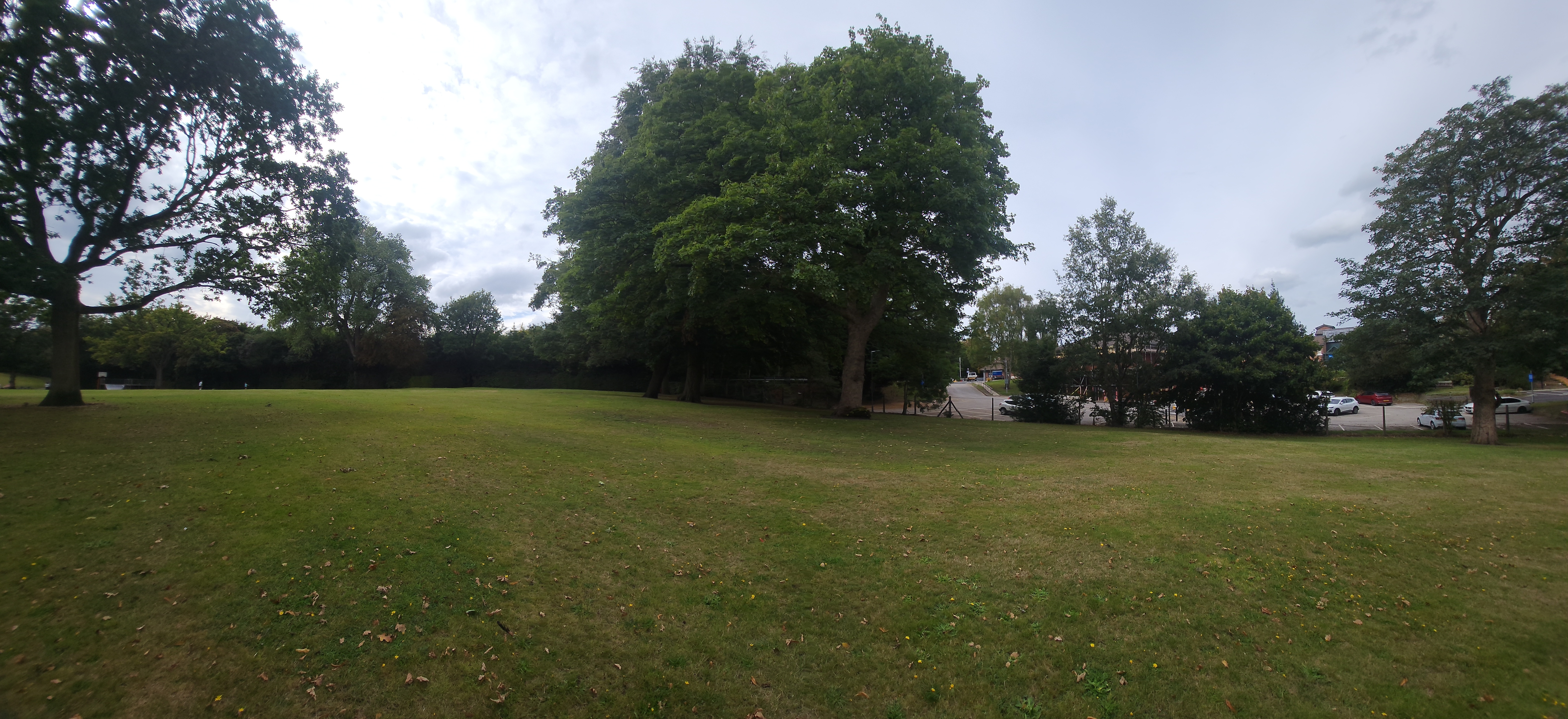
The Bandstand
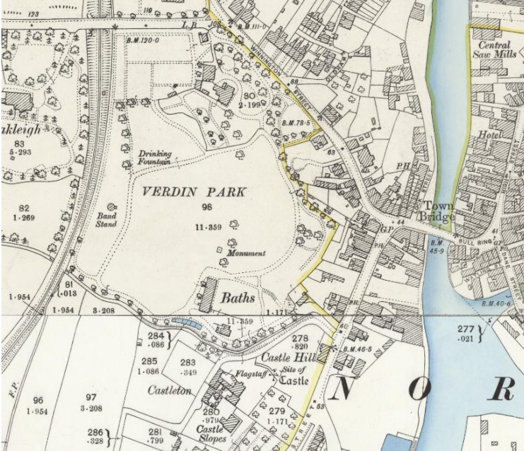
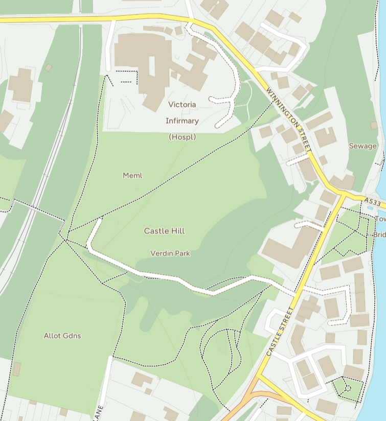
A gift from Joseph Verdin, an octagonal masterpiece designed for the music of brass bands — and cleverly engineered to survive the very ground sinking beneath it. The 1908 Ordnance Survey map confirms its exact location — the area now proposed as an overflow car park for the hospital.
A Brother's Gift
Completing the vision
When Robert Verdin died unexpectedly in July 1887, the park he had given to Northwich was still taking shape. His brother, Joseph Verdin — Justice of the Peace, Alderman, and one of the most prominent men in mid-Cheshire — stepped in to complete what Robert had started.
On 5 July 1890, the Northwich Guardian announced that work had commenced on a new bandstand in the park — a gift from Joseph Verdin of The Brockhurst. The band kiosk, as it was called, had been designed by the same man who designed the baths: James Holland of Castle.
The bandstand completed a vision for the park as a place where working families could enjoy the same leisure and entertainment that wealthier households accessed privately. Music in the park was not entertainment for the few — it was a public institution, a weekly gathering, a statement that culture belonged to everyone.
Local brass bands, heavily supported by the salt and chemical industries, had become one of the defining features of working-class culture across Cheshire. The bandstand gave them a permanent home in the heart of Northwich.
Sir Joseph Verdin
Joseph Verdin was born in Witton, Northwich in 1838. Like his brother Robert, he was a salt industrialist and a significant public benefactor. He was elevated to the Baronetage in July 1896 and knighted in 1897.
By the time he funded the bandstand, the family business — Joseph Verdin & Sons — was the largest salt manufacturer in the United Kingdom, producing over 353,000 tons annually from six salt plants across Cheshire.
The Design
An octagonal kiosk built for sound — and for survival
The Northwich Guardian of 5 July 1890 published a detailed description of the proposed structure. It is a remarkable document — precise, technical, and revealing about how seriously the town took the design of its new landmark.
Octagonal plan
The structure was octagonal in plan — the classic Victorian bandstand form, allowing musicians to project sound in all directions across the surrounding lawns.
Ruabon red tiles
The main roof was covered with Ruabon red tiles — a distinctive Welsh terracotta tile widely used in Victorian public buildings — topped by a lantern light of small coloured glass squares.
A floriated finial
The lantern at the centre of the roof terminated in a floriated finial — an ornate decorative flourish typical of the Victorian Gothic revival style.
Engineered for sound
James Holland devised special means for allowing musical sound waves to escape through the roof — a practical acoustic consideration built into the structure from the start.
Diagonal framing and glass
The lower portion featured diagonal framing with open arched head panels; above were ornamental panels filled with glass beneath the eaves, combining lightness with shelter.
Built to be raised
In a remarkable concession to Northwich's geology, the entire sill and structure was built so that it could be lifted on screw jacks should the ground ever subside beneath it — at, the Guardian noted, "a very small cost."
From the Northwich Guardian, 5 July 1890
“The sill, and the whole portion of it, including the floor, will be so constructed and bound together, that it can be easily lifted by screw jacks, at a very small cost, should the ground at any time unfortunately subside.”
The contractors were Messrs Rylance and Taylor of Witton-street. The structure above the York stone plinth was of varnished pitchpine, with a pre-sed brick base. The overhanging eaves were supported by moulded and perforated wood brackets fixed to each angle pillar.
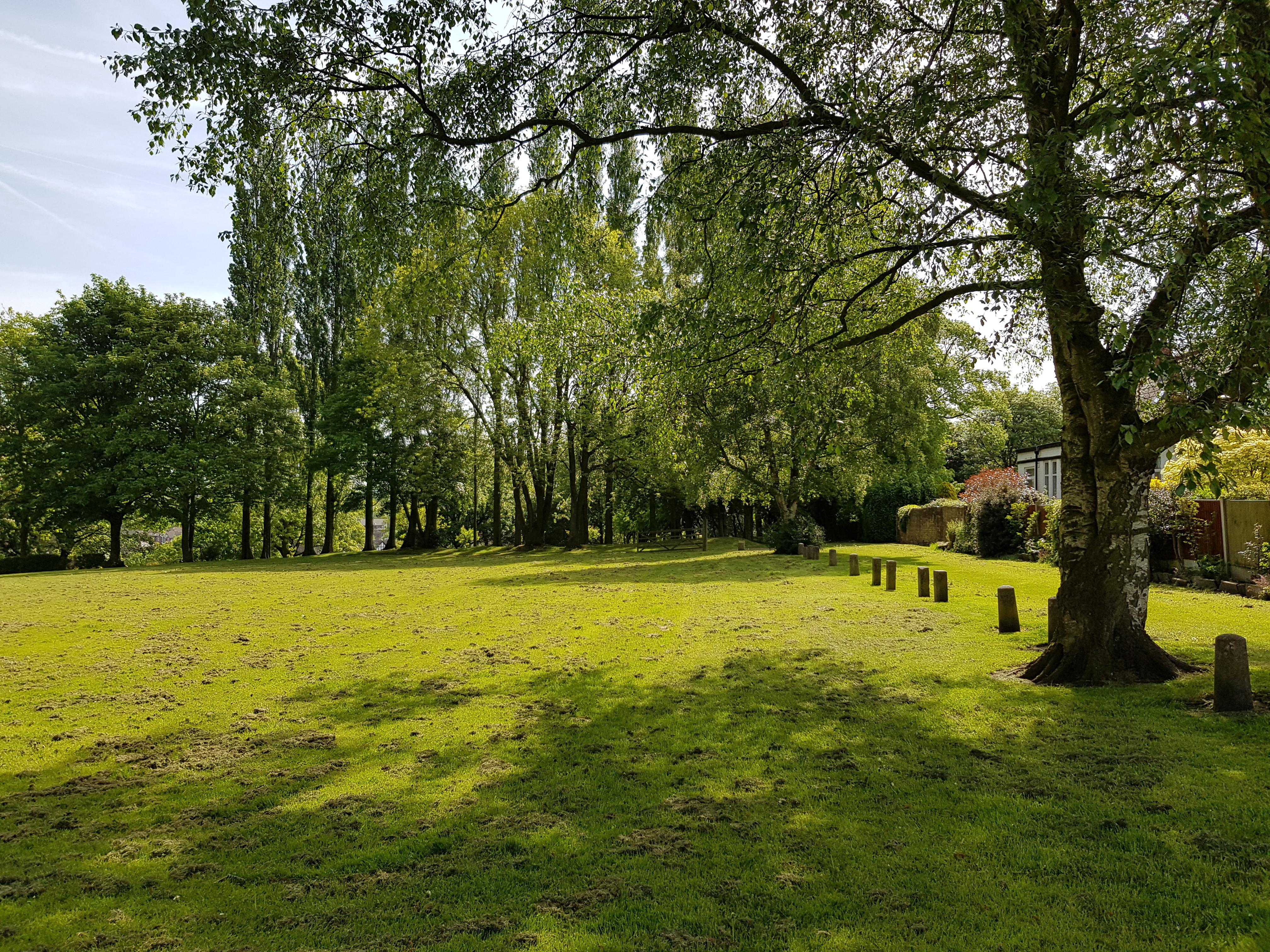
The park's open lawns provided a natural amphitheatre for Sunday band performances.
Victorian Entertainment
The beating heart of a weekend in Northwich
Throughout the late Victorian and Edwardian eras, Sunday afternoon at the bandstand was a fixture in Northwich's social calendar. The town's brass bands — many of them attached to the salt works and chemical companies that lined the Weaver valley — were accomplished, competitive outfits with strong community followings.
Families spread out across the lawns and gravel paths. Children played on the slopes. Workers who had spent the week in the salt pans or the brine pumping stations sat in the park and listened. The bandstand was not merely a piece of park furniture — it was an institution.
By 1908, the Ordnance Survey recorded the park's full layout: baths, bandstand, monument, drinking fountain and a network of paths across the grounds. The map clearly marks the bandstand's location — the area where a concrete foundation still sits today, and the area now proposed as an overflow car park.
1939 – 1945
A bandstand in wartime
During the Second World War, Verdin Park found itself pressed into service once more. Volunteers gathered at the bandstand to fill sandbags, which were then placed in front of the Victoria Infirmary's windows to protect the building — and its patients — from bomb blast. The bandstand that had once anchored summer Sunday concerts became a staging point for civil defence.
“During the war volunteers filled sandbags by the bandstand and the bags were put in front of the Infirmary's windows in case of a bomb blast.”
Warrington Guardian — a recollection of wartime Verdin Park
What Remains
A concrete slab — and a live proposal
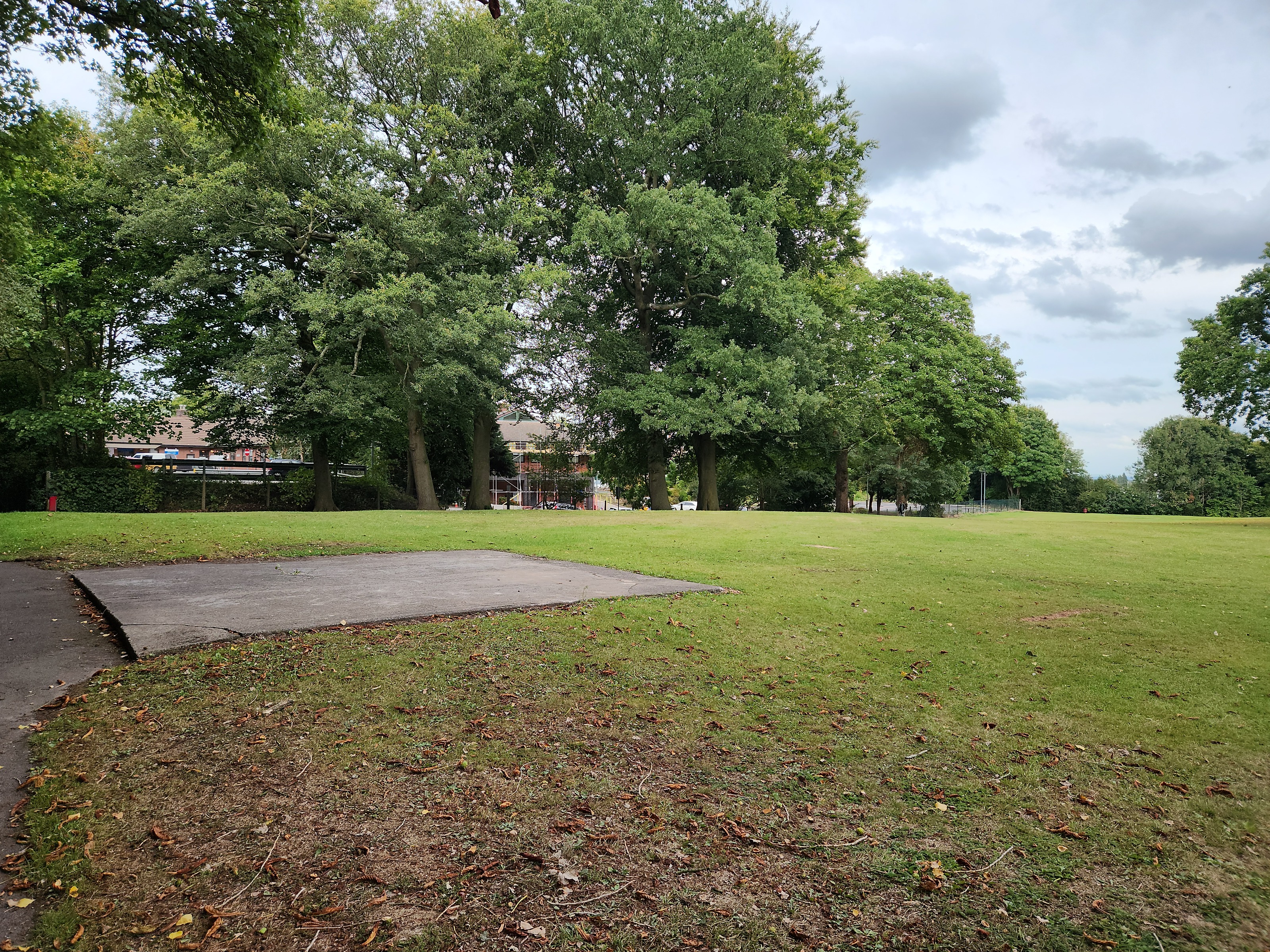
The Verdin Park Bandstand no longer stands. When exactly it was removed is not recorded in the historical sources available — it survived the war, but at some point in the second half of the twentieth century it was taken down.
What remains is a concrete foundation in the grass, marking the site. The 1908 Ordnance Survey map confirms this location — and it is the area of the park that has been identified in proposals for an overflow car park serving the nearby hospital. The ground where Northwich's Victorian bandstand stood for decades is the ground now under discussion.
The bandstand represents a wider pattern in the park's history: a layer of Victorian civic generosity — the baths, the bandstand, the ornamental cascades, the laburnum avenue, the tennis courts — that was gradually lost through the combined pressures of subsidence, time, and changing expectations of public space. What survives today — the gates, the statue, the mature trees, the paths — is the skeleton of something once much richer. The question now being asked is whether any more should be lost.
What Survives in the Park Today
- The statue of Robert VerdinStanding
- The Cast Street entrance gates and gate piersRestored 2021
- The half-timbered Lodge on Winnington LaneStanding
- The mature trees — oaks, limes, poplars, laburnumPresent
- The central path and stone bollardsPresent
- The Verdin BathsDemolished 1912
- The bandstandRemoved, date unknown
- The ornamental cascadesLost
- The tennis courts and bowling greensDeveloped
A Park in Retreat
How the park was lost — and when
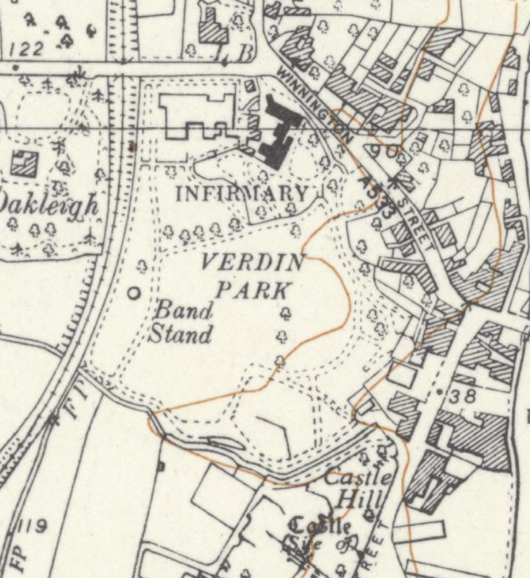
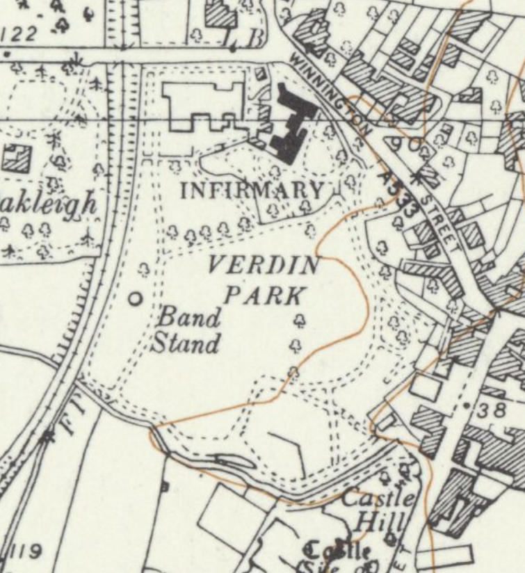
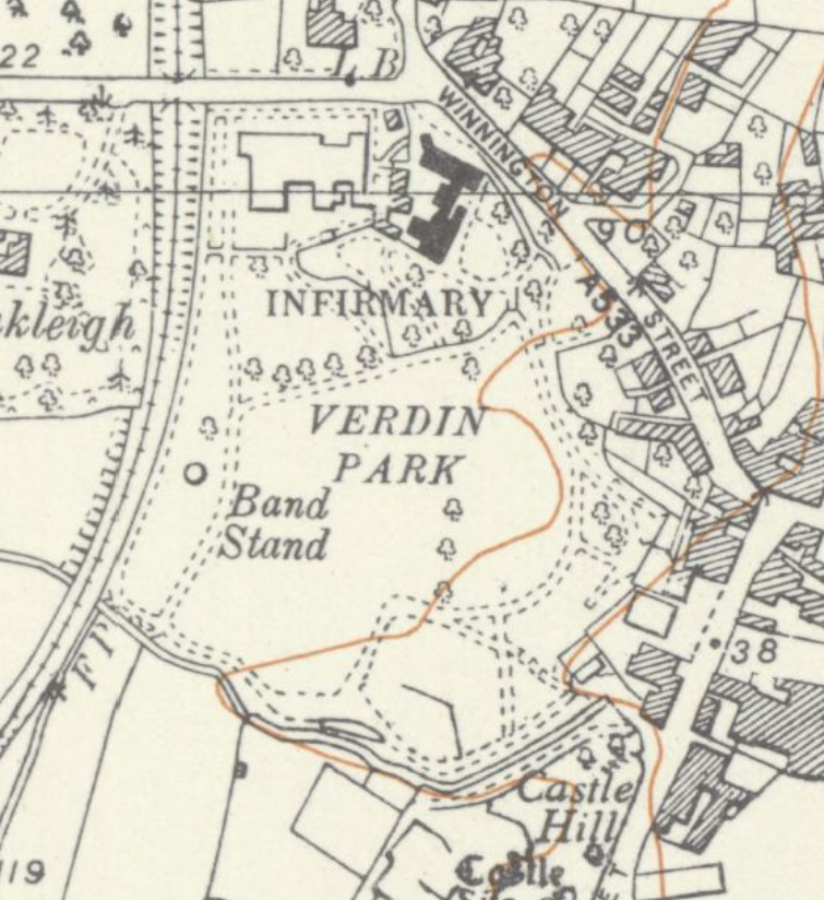
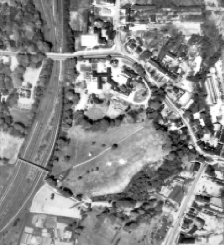
Ordnance Survey maps from 1908 to 1970 consistently show the bandstand in place and the park boundary intact on the western side. A 1973 aerial photograph shows the existing hospital car park under construction with the boundary already pushed to the railway line. The park land was taken, and the bandstand removed, sometime between 1970 and 1973.
The bandstand appears on OS maps as late as 1970. The existing hospital car park was under construction by 1973. Both the bandstand and the park land to the west were lost in the same narrow window — circa 1970–1973.
1908
The park as gifted
1954
Bandstand still present
1961
Bandstand still present
1970
Last OS map with bandstand
c.1973
Car park under construction
2026
What remains today
OS maps © Crown Copyright and database right. Aerial imagery sourced from historic survey records.
Sources & Further Reading
- Cheshire Gardens Trust — Verdin Park Research Report (2021)
- Cheshire Gardens Trust — Verdin Park Historic Images (2021)
- Sir Joseph Verdin, 1st Baronet — Wikipedia
Primary sources include the Northwich Guardian of 5 July 1890 (bandstand description) and the Warrington Guardian (wartime recollections), held in the British Newspaper Archive. The Cheshire Gardens Trust report (© Cheshire Gardens Trust, all rights reserved) is referenced here by attribution only.